Church of England Parish boundaries are no longer relevant to much of our lives. They don’t necessarily correspond to the boundaries of electoral wards or towns. They’re relevant if you want to join the electoral roll of a CofE church or vote in the annual election of churchwardens and also concerning the reading of Banns of Marriage.
Glastonbury is covered by two CofE parishes: St John the Baptist and St Benedict. Despite the commonality of names, the boundaries of these parishes have little or no correspondence with the 4 District Wards covering Glastonbury: St John’s, St Benedict’s, St Edmunds and St Mary’s.
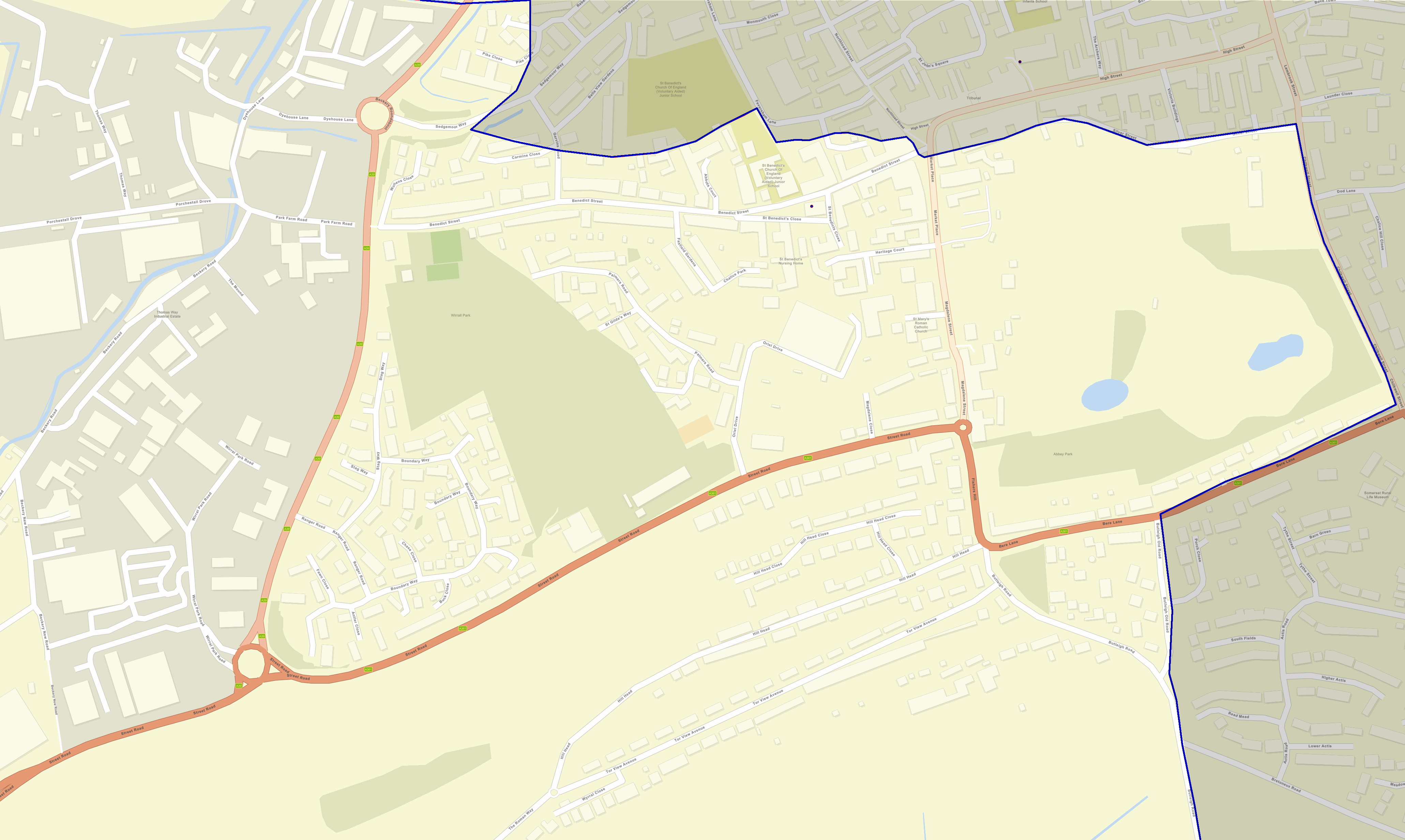
The parish boundary of St Ben’s Church is rather strange, no doubt rooted in history of which the author of this page is woefully (or possibly blissfully) ignorant. Immediately below is a map showing the complete outline. You can click on the image to display it is with a little more detail and zoom it, but for street discernible detail in the central area of Glastonbury, click on the high resolution picture further down.
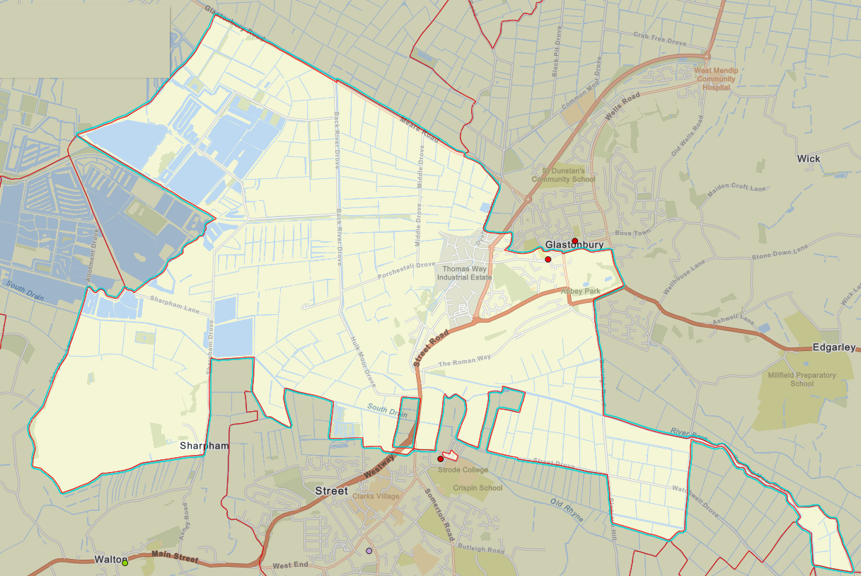
The thin extension to the south and east ending in a what looks like a field is bordered by the Brue and Kennard Moor Drove. Even stranger, there’s that small “island” adjacent to Street Parish Church (the red dot) and Strode College. What history lurks there?
The boundary divides the town in a non-obvious way. Part of that is about encompassing the Abbey and its grounds including Abbey House, but notice how St Benedict’s School is in our parish, but the playing field isn’t!
Click to view and zoom in a new tab.
These maps were produced using the arcgis map found at this link.
The parish boundary data are provided by The Church of England Research & Statistics unit.
The information may not be used for profit.